Cemetery Maps

These maps help you locate a grave at Kinder Cemetery by its plot code (for example, 23N means block 23, north). Because the ground is uneven and many early markers are worn or missing, the positions shown are approximate.

Select any map to open it full size for closer reading.
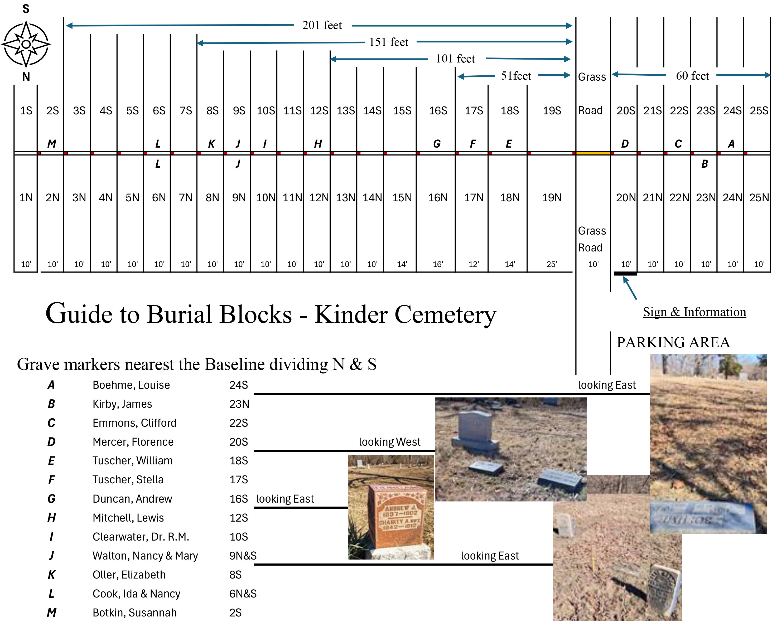
Quick-guide map of Kinder Cemetery showing the numbered blocks and their north/south sections laid out across the grounds.
Block quick-guide — the numbered blocks and north/south sections at a glance.

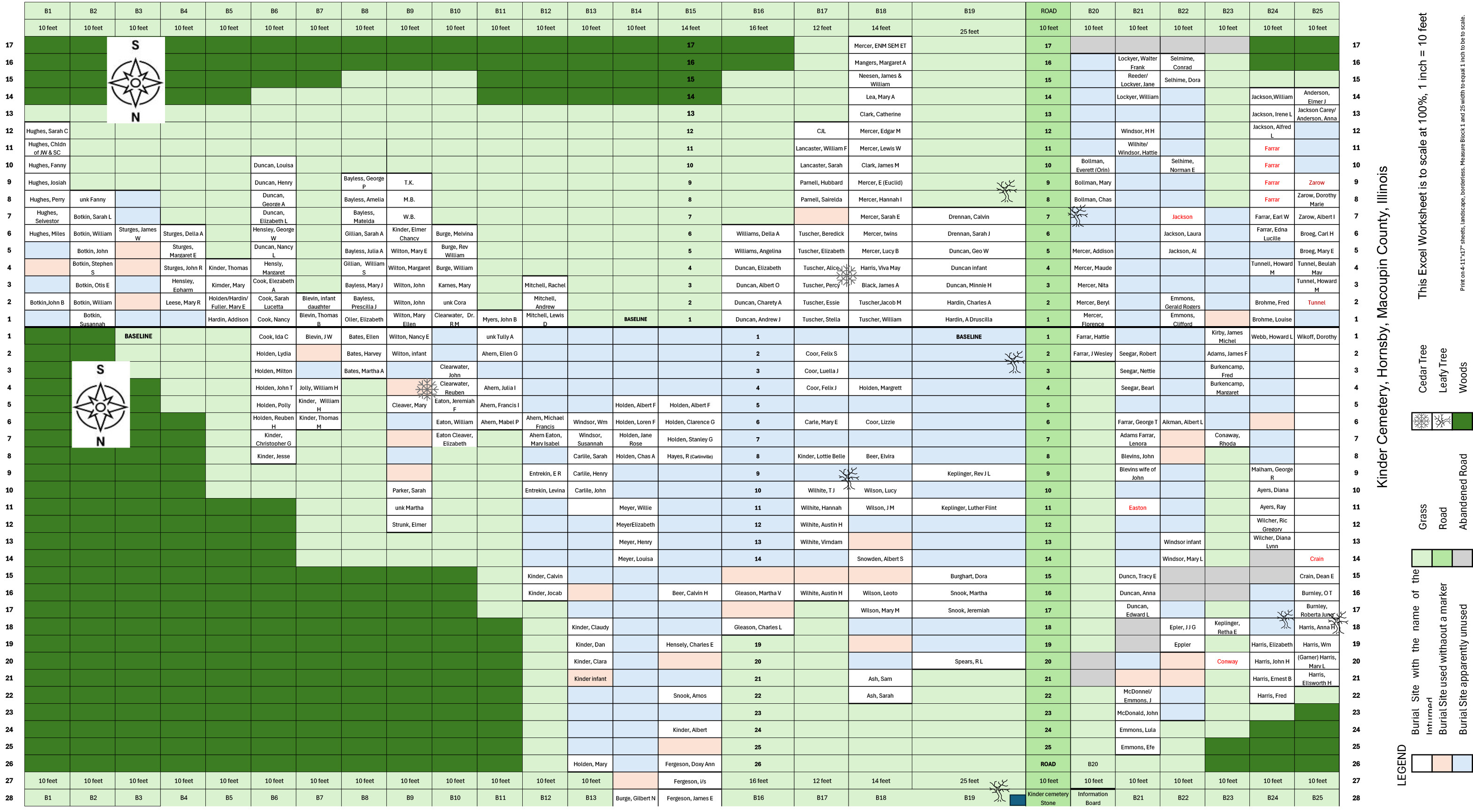
Approximate locations of burial markers

Due to uneven ground, these are approximate locations of burial markers.
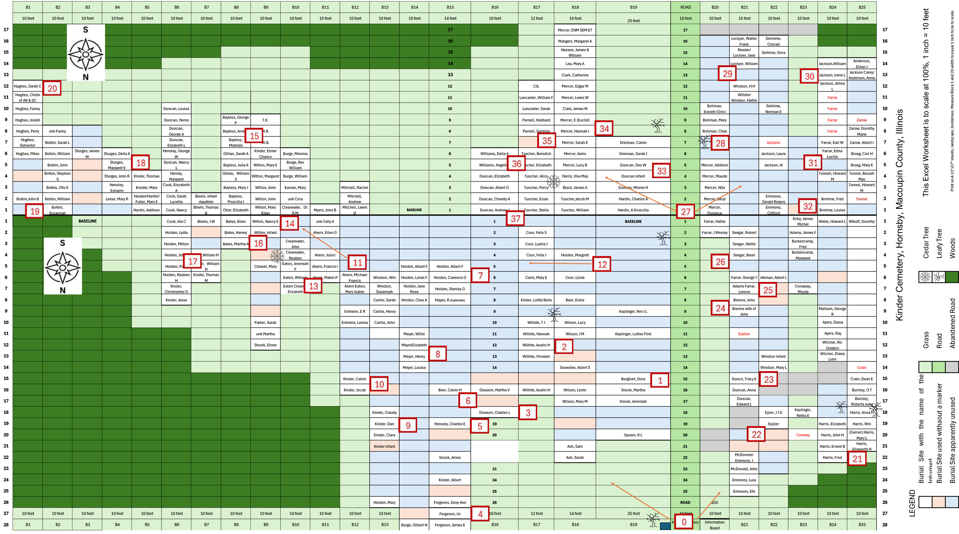
Detailed base map of Kinder Cemetery with numbered guide points marking blocks and rows across the burial grounds.
Base map with guide numbers.
Base map of Kinder Cemetery labeled with the family surnames associated with each block and section.
Base map with family names by section.

Orientation guide by prominent markers

A cemetery orientation guide using the prominent burial markers shown below.
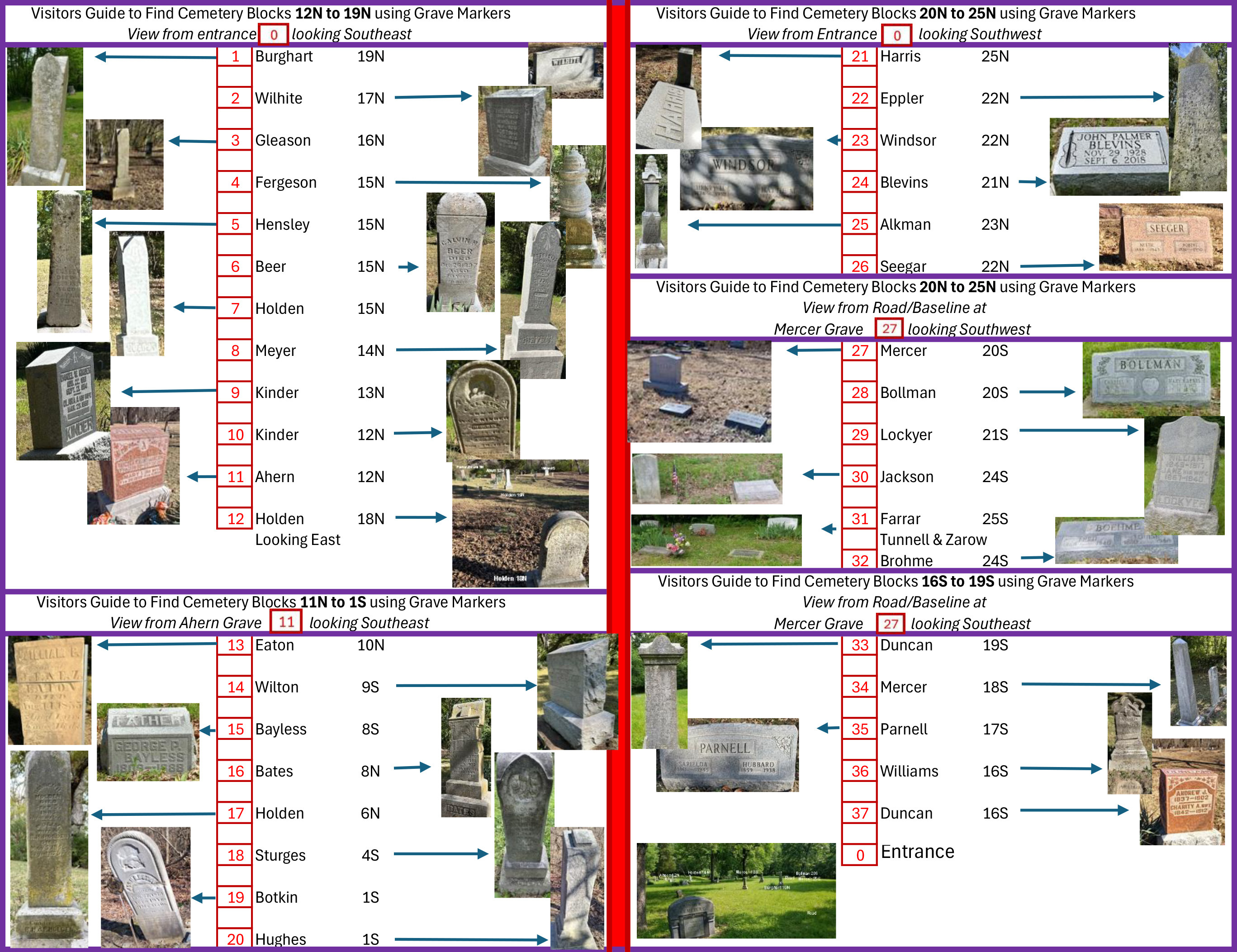
Stone guide illustrating prominent, easily recognized burial markers used as landmarks for orienting yourself within Kinder Cemetery.
Stone guide — prominent markers to orient by.

Once you know a plot code, you can find everyone recorded in that plot using the Burial Directory — search or sort by the Plot column.